Effective as of 12:00 AM Monday December 27 2021
View the latest severe weather warnings from BOM at http://www.bom.gov.au/wa/warnings/ .
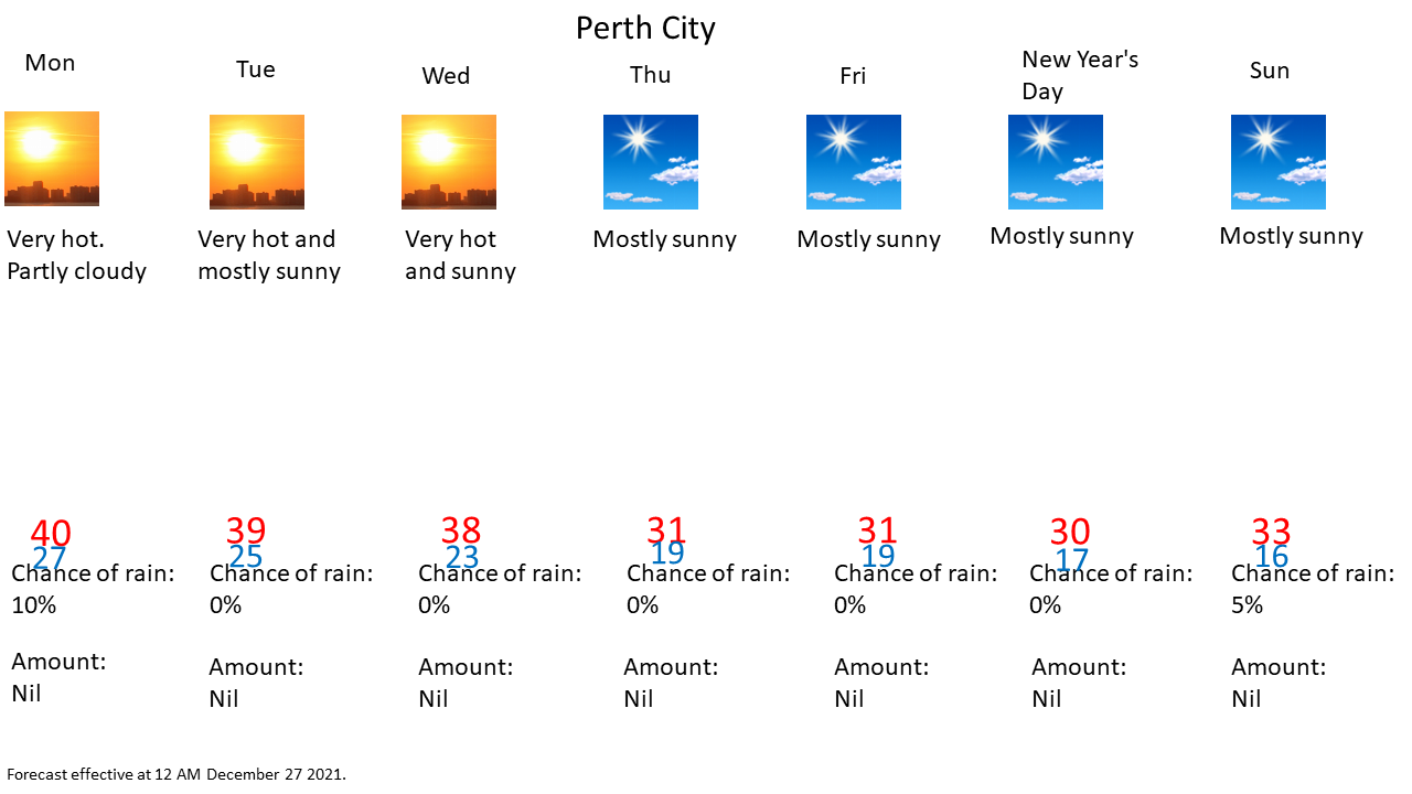


Explanatory notes:
With a maximum of 43.5°C at the official Perth Metro station on Boxing Day, Perth has seen the second hottest December day on record and the hottest since Boxing Day 2007, when maximum temperatures reached 44.2.°C There was some cloud cover, in the absence of the clouds, temperatures could have been higher.
Perth has also seen the hottest Christmas Day on record with a maximum temperature of 42.8°C at the official Perth Metro station beating the record of 42.0°C set in 1968. In fact, it was the hottest Christmas Day on record for any Australian capital city and possibly any major city in the world based on maximum temperatures at the official stations.
The previous hottest Christmas Day in an Australian capital city was 42.1°C in Adelaide in 1888, but then Stevenson Screen's weren't widely used yet and so such a record is not directly comparable to modern times.
Very bad fire conditions with such high temperatures and dry easterly winds. Some fires had flared up in the afternoon with the smoke plume even being visible on radar.
Easterly winds strengthened again at night as vertical mixing decreases, gusts in excess of 75 km/h possible over the hills and foothills early today, with the strong easterly gradient combined with katabatic effect.
Earlier onset of and a more significant sea breeze and the upper level anticyclone being displaced by an upper level trough means that maximum temperatures today, Tuesday and Wednesday would likely be slightly lower, but still very hot. Some cloud cover ahead of the upper level trough also expected to limit maximum temperatures a little today.
The heatwave ends by Thursday as the west coast trough moves inland with the marine layer advecting onshore.