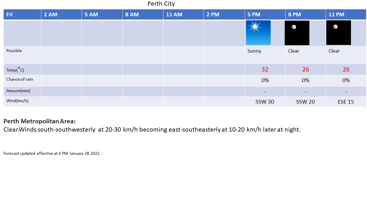
Effective as of 12:00 AM Saturday January 29 2022
View the latest severe weather warnings from BOM at http://www.bom.gov.au/wa/warnings/ .
Explanatory notes:
Becoming very hot as the west coast trough deepens off the west coast, also the possibility of showers and thunderstorms with steep vertical lapse rates, most likely over the hills east of the sea breeze front.
Again, some respite next week as cooler air moves in from the southeast, still hot days but not as hot and cooler nights as well with cool air advection from the southeast and radiational cooling of dry air.
Significant east-southeasterly, then easterly gradient flow will suppress sea breezes from Monday with strong gusts over the hills and foothills early and ate at night with katabatic enhancement of the flow.


