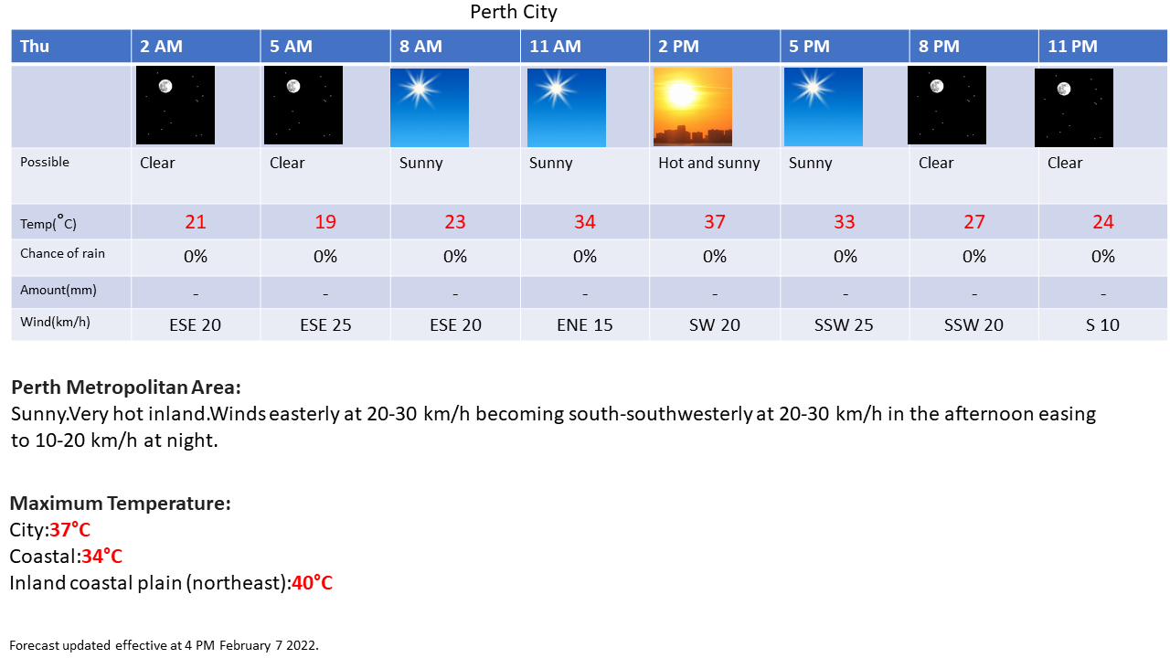
Effective as of 12:00 AM Tuesday February 8 2022
View the latest severe weather warnings from BOM at http://www.bom.gov.au/wa/warnings/ .
Explanatory notes:
A significant cold front for February moved across the region bringing some showers and the first rainfall since December for many places with a cool air mass in its wake bringing the coolest day since December at the Mt Lawley site on Monday with some isolated showers early which cleared as the subtropical high pressure ridge builds to the south.
Fine conditions today and Wednesday with afternoon sea breezes with the subtropical high pressure ridge to the south and the west coast trough inland.
Becoming hot again on Thursday as hot air mass advects over the region with the west coast trough deepening offshore before moving inland on Friday bringing cooler conditions.


